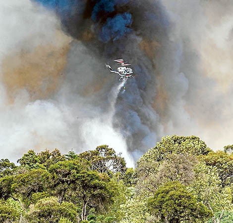
BUSHFIRES classed as “catastrophic in consequence and of extreme risk” are “almost certain” at some stage on the Mornington Peninsula – possibly this summer.
Areas threatened by this nightmare scenario described in a fire management plan adopted by Mornington Peninsula Shire are the Arthurs Seat lookout and maze, parts of Blairgowrie near Pt Nepean Road and along the Stony Point and Frankston-Flinders roads to Stony Point.
Other areas “almost certain” to burn with “major” consequences are the Joseph Harris Scout Camp in Hearn Road, Mt Martha, the high voltage transmission lines at Dromana and the Arthurs Seat communications towers.
The hard-hitting assessments in the fire management plan also acknowledge the peninsula is “one of the most bushfire-prone areas in the world”.
The plan assesses 130 sites for their fire danger.
It says risks of death are heightened by the number of visitors to the peninsula with evacuation hampered by narrow, bush-lined roads.
The management plan says “catastrophic” fires are “likely” at Red Hill, Main Ridge, Melbourne Road to Dundas Street, Balnarring racecourse, the Port of Hastings and parts of Crib Point.
The management plan aims to “identify, prioritise and co-ordinate treatment of fire risks” as well as engaging the community to actively prepare to face the fire threat.
The shire is using the data to add weight to its campaign to make the peninsula more fire-ready by using recycled water from the Carrum treatment plant to fight fires (“Uses for waste water” The News, 9/10/2018).
The peninsula is serviced by two CFA fire brigades: Western Port group with 13 brigades and Peninsula group with eight.
Major bushfires have threatened life and property on the peninsula since the early days of European settlement.
The management plan lists fires as far back as 1851 “around Western Port”; the 1939 Black Friday bushfires when 43 houses were destroyed at Dromana; fires in 1951 around Flinders Naval Depot (now HMAS Cerberus); and 1967, when “one of the biggest fires the peninsula has experienced” razed parts of Red Hill.
In January 1997 a fire started near Churchill and Park roads, Mt Martha, and involved 61 firefighting units and 336 firefighters over two days. Between 20 and 40 hectares of Mt Martha Park were destroyed.
The next day, at Arthur’s Seat, 400 people fought a deliberately lit blaze that burnt 160 hectares of bushland. Houses along Purves Road, Seahaze Street, Nestle Court and Towerhill Road, and Gully and McLear roads, were all at risk and residents evacuated.
Blazes destroyed bushland and areas of state parks, threatened houses, blocked roads and endangered CFA crews in 2003, 2008, 2009 and 2014.
In January 2015 fire destroyed almost half of the 146 hectare Warringine Park, Hastings. In October of that year, 16 trucks fought a grass and scrub fire at BlueScope Steel’s recreation reserve in Denham Road, Tyabb. The early morning blaze burnt out five hectares before being stopped 300 metres from the steelworks.
In January 2016 a fast-moving bushfire mysteriously ignited near the Crib Point refinery and headed south towards the town. One house and six sheds were destroyed with another house damaged. The next month a fire on Frankston-Flinders Road northwest of Somerville destroyed 800 metres of rail sleepers on the Stony Point line.
First published in the Southern Peninsula News – 9 October 2018


