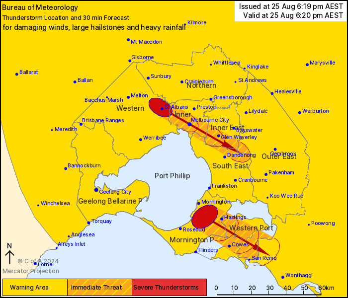
Severe thunderstorms have been forecast for the majority of Victoria today and are heading eastwards towards the Mornington Peninsula.
A strong cold front with strong associated upper-level winds is crossing the state. This high-instability, high-shear environment is producing conditions conducive to severe thunderstorm development, unusual for this time of year.
Severe thunderstorms are currently impacting to the north and west of Melbourne produce damaging winds, large hailstones and heavy rainfall that may lead to flash flooding in the warning area over the next several hours; Bendigo, Maryborough, Castlemaine, Kyneton, Ballarat and Bacchus Marsh.
Three-centimetre hail has been observed near Bendigo.
The system is fast moving with potentially damaging winds.
The SES are advising to begin preparations immediately by:
– Parking your vehicles undercover and away from trees
– Tying down loose items such as outdoor furniture and trampolines
– Beware of the risk of falling trees and avoid walking in high risk areas during periods of high winds.
South East Water have warned severe weather may impact their network.
A SEW statement has said “due to run-off and discharges associated with heavy rain, the quality of water in waterways, Port Phillip Bay beaches, and flooded areas may not be suitable for human health or pets. Avoid contact with either flowing or flood waters during this time.”


